
")
The Earth is the largest known alembic. But not for spirit, just plain water!
From the ocean surface, mostly in warm tropical zones, and by transpiration of plants, water is vaporized into the atmosphere, ascends to colder altitudes where, initiated by fine dust and aerosols, it will be condensed to build-up clouds of droplets or snowflakes that eventually will fall on our heads in the form of rain, hail or snow. With a latent heat of vaporization of 2444 J/g (at 14°C), huge heat transfers accompany these alternating processes.
Soil moisture is brought by rainfalls or by irrigation from streams that are fed by rain. This is an essential component of a local climate since it determines the ability to develop flora and fauna at a given location.
On average, the yearly rainfalls on Earth are approximately 1130 mm/m2, with a high variability across seasons and between regions. According to US-EPA[1] the global precipitations increased between 1901 and 2012 by +0.022 % per year.
Global data integrating all local data is not readily available. Local precipitation evolution is represented in the following graphs.
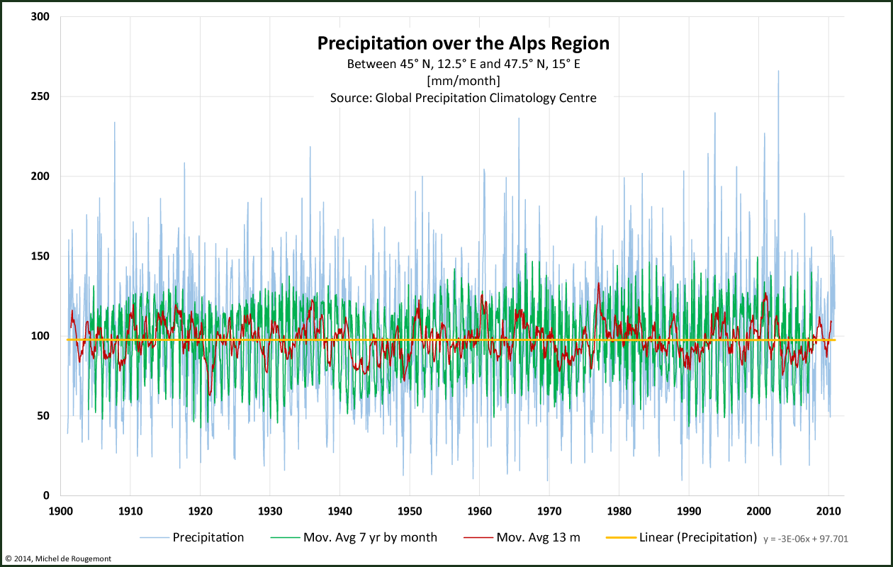
Precipitation over the Alps.
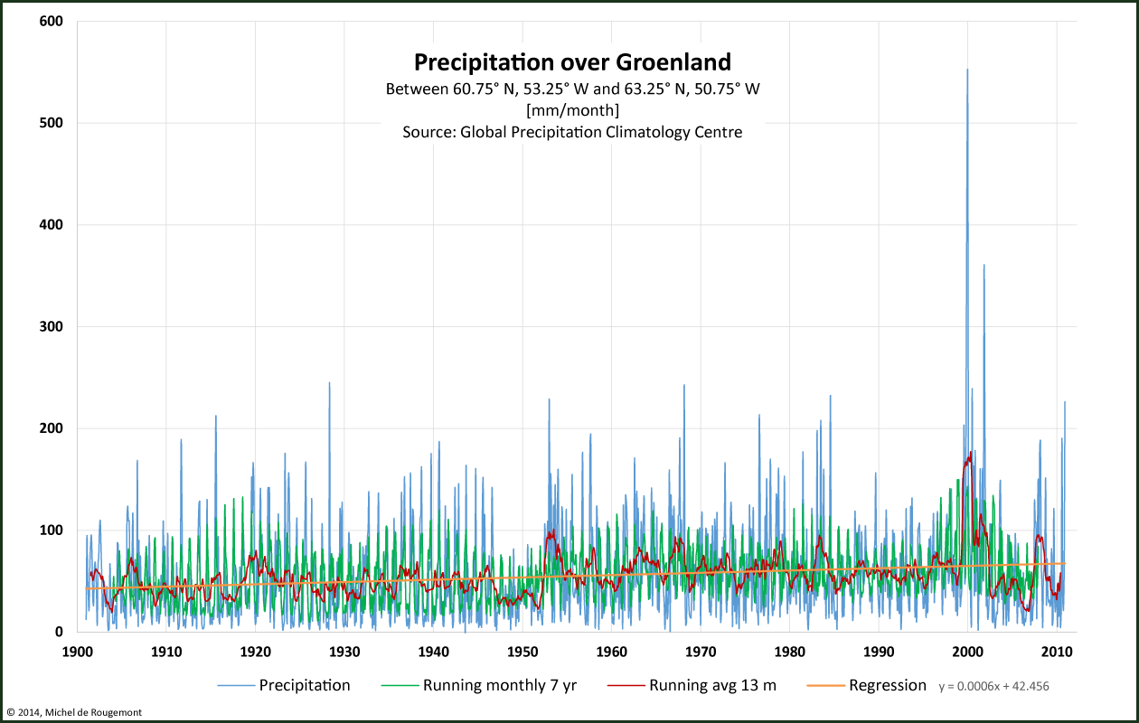
Precipitation over Greenland. Note exceptional periods around 1950 and 2000.
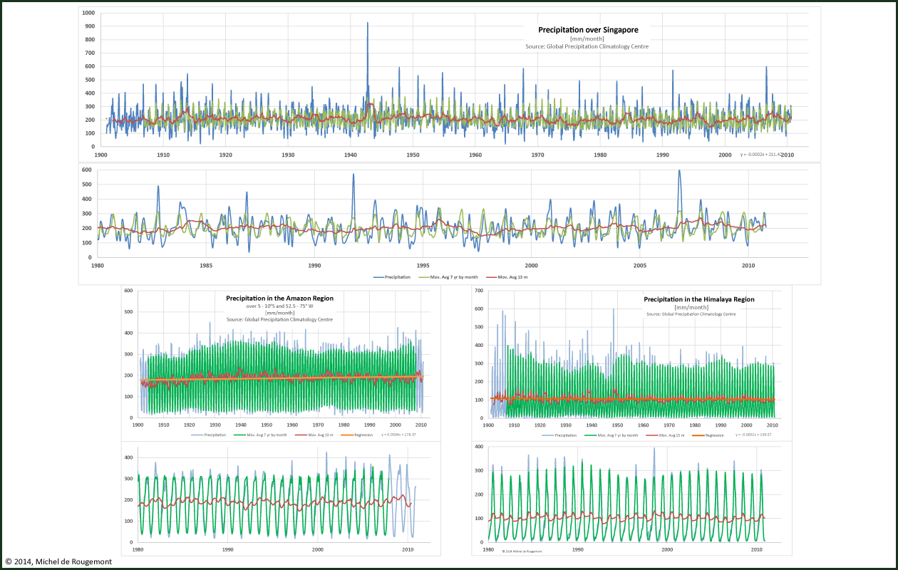
Precipitation over Singapore, the Amazon region, and the Himalaya
Source: Global Precipitation Climatology Centre, hosted by www.dwd.de
Trend lines show following changes:
Alps region no significant change
Greenland +21.9 mm/month per century, a 40% increase
Singapore -7.3 mm/month per century, a 3.5% decrease
Amazon +14.6 mm/month per century, a 6.8% increase
Himalaya -7.3 mm/month per century, a 6.9% decrease.
Shorter term variations may not be an indicator of climate change, even when drought periods or floods are observed.
[1] http://www.epa.gov/climatechange/pdfs/precipitation_documentation.pdf